Hurricane Hilary Currently A Category 4 Storm, First Ever Tropical Storm Watch Issued For Southern California
By Keemia Zhang and Dolores Quintana
This article has been updated as of Friday, August 18, at 11:00 a.m. Hurricane Hilary is expected to make landfall in Southern California by Monday, the fourth such storm to ever hit Southern California and the first hurricane since 1939. According to the National Weather Service of Los Angeles, the storm has already been declared a Category 3 hurricane on Thursday evening and was upgraded to a “powerful” Category 4 storm later that night. It remains Category 4 this morning.
The National Weather Service has declared the first-ever tropical storm watch for the Los Angeles area. The warning states, “A Tropical Storm Watch has been issued for Catalina and Santa Barbara Islands, Antelope Valley Foothills, San Gabriel Mountains, Interstate 5 Corridor, Santa Clarita Valley, and Highway 14 Corridor.”
The watch includes significant warnings about the possibility of flooding and high winds in Los Angeles County, “Prepare for life-threatening rainfall flooding having possible extensive impacts across Los Angeles and Ventura Counties and possibly Santa Barbara County. The most dangerous conditions are expected over the mountains.”
Potential impacts include: “Major rainfall flooding may prompt many evacuations and rescues. Small streams, creeks, canals, arroyos, and ditches may become dangerous rivers. Destructive runoff may rage down mountain
valleys while increasing susceptibility to rockslides, mudslides, and debris flows. Flood control systems and barriers may become stressed. Streets and parking lots could become rivers of moving water with underpasses submerged. Driving conditions become dangerous. Many road and bridge closures with some weakened or washed out.”
A tropical storm can have winds anywhere between 39 to 73 mph. According to the NWS Los Angeles, the types of wind damage can include “Damage to porches, awnings, carports, sheds, and unanchored mobile homes. Unsecured lightweight objects are blown about. Many large tree limbs could be broken off. A few trees could be uprooted, but with greater numbers in places where trees are shallow-rooted. Some fences and roadway signs were blown over. Some roads could become impassable from debris, particularly within urban or heavily wooded places. Hazardous driving conditions on bridges and other elevated roadways. Possible scattered power and communications outages.”
Weather services stress that it is too early to predict the storm’s path, which could change.
The National Weather Service of Los Angeles is “still expecting significant impacts for Southern California Sunday through Monday.” and notes that the storm will likely bring “the potential for significant marine issues Sunday-Monday: High surf – Strong winds – Dangerous rip currents – Coastal flooding/beach erosion – Dangerous conditions for S and SE facing harbors.”

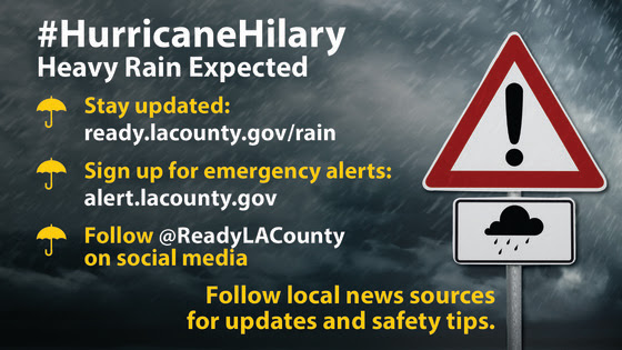
Los Angeles County Department of Social Services has already sent out an alert that reiterates to residents that the storm will cause “rough surf and dangerous winds to L.A. County beginning late this Sunday through Monday. Some areas could see up to five inches of rain. DPSS urges residents to take precautions and stay updated by signing up for emergency alerts at ready.lacounty.gov and following the department on social media @ReadyLACounty.” For tips on storm preparedness, you can check Ready LA County.gov Rain.
The City of Santa Monica issued an alert today about the storm noting that The National Weather Service of Los Angeles has issued a flood watch for Los Angeles County. “from Sunday afternoon to Monday evening.” and urges residents to “take action now to prepare for storm activity.” directing people to the city’s extreme weather preparedness webpage.
The advice on the page states, “Heavy, prolonged rainfall and thunderstorms along the California coast can result in coastal and large-scale urban flooding. Monitor weather reports via www.weather.gov and take action if an active weather alert is issued for Santa Monica. If major rain events are in the forecast, stay home as much as possible. Never drive through standing water or areas closed by public officials.
Thunderstorms and other weather events, like windstorms, can have additional impacts, such as power outages and downed trees and power lines. Avoid downed power lines and anything that may be touching them – especially water. If power outages are detected, please contact SoCal Edison for outage updates via SCE.com/outage. Stay updated on local weather impacts by signing up for SMAlerts notifications.”
Tropical cyclones have rarely made landfall in Southern California – the San Diego Hurricane of 1858 was the only one to have landfall as a hurricane, followed by the Tropical Cyclones of El Nino in 1938 and 1939. Other tropical storms affecting Los Angeles-area residents include the Long Beach Tropical Storm in 1939, Nora in 1997, Kathleen in 1976, and Kay in 2022.
The National Hurricane Center estimates that Hilary will come onto American soil with 60mph sustained wind and 40-60 wind gusts in Southern California. Local concerns include flash flood warnings in other counties – with particular caution to residents near former fire sites – and rainfall varying from 2-8 inches, depending on the area. Risks of lightning also indicate a possible fire hazard.
Southern California is typically protected from full-level hurricane-intensity storms due to colder seawater and upper-level searing winds – however, this year’s El Nino indicates that ocean temperatures are warmer. August is typically one of the months on the California coast with limited rainfall.


